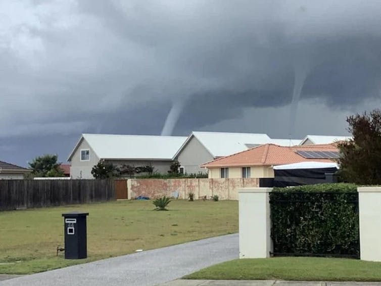
What are waterspouts, and how do they form? An expert explains
- Written by Dean Narramore, Senior meteorologist, Australian Bureau of Meteorology
Waterspouts are extraordinary, impressive weather events. Observers describe them as looking like “the start of an alien invasion” and post their snaps across social media.
But what are these enigmatic offshore twisters, and what causes them to form?
What is a waterspout?
A waterspout is a spinning column of air that sucks up water (usually from the ocean) to make a twisting funnel of water and cloud connecting the sea and the sky.
They are spectacular but short lived, usually lasting no more than five minutes (but occasionally up to ten minutes). Winds inside the waterspout can be faster than 100 kilometres per hour, and they can do great damage to boats at sea.
If they drift ashore, waterspouts can create even more havoc: the Lennox Head tornado in 2010 destroyed a dozen homes in northern NSW.
Waterspouts are in some ways like the tornadoes that form over land. But where tornadoes are associated with huge supercell thunderstorms, waterspouts can form during smaller storms or even just showers or the presence of the right kind of clouds.
Read more: Tornadoes in Australia? They're more common than you think
How do waterspouts form?
Waterspouts can form when winds blowing in two different directions run into each other. Along the line where the two winds meet (called a “convergence line” or “shear line”), there is a lot of rotating air near the surface.
The collision of the two winds makes air move upwards because it has nowhere else to go. This rising air carries water vapour high into the sky where it creates rain showers, storms and cumulus clouds.
 Waterspouts off the coast at Harrington in NSW.
Sue McDonald, Author provided
As the air rises, it can tilt some of the horizontal spinning air near the surface into the vertical direction. When this vertical spin concentrates at a particular point it starts sucking up water — and you have yourself a waterspout.
Because waterspouts form on the line where two winds meet, you sometimes see a line of waterspouts in a row where the spinning low-level air is sucked upwards at a few different points.
When and where are waterspouts most common?
In Australia, waterspouts are most common along the NSW and Queensland coast.
Most mornings, cooler nighttime air blowing off the land meets warmer air sitting out to sea. Usually this results in a line of clouds sitting offshore where the two air masses meet.
Under the right conditions — most often in autumn and winter, when the land gets colder but the sea stays relatively warm — the collision becomes more dramatic and waterspouts appear.
Can we forecast waterspouts?
Waterspouts look very big and impressive to the casual viewer, but to a meteorologist looking at the world’s weather patterns they are quite small. This makes them very hard to forecast with any level of confidence.
Read more: Curious Kids: how do people know what the weather will be?
We know the kind of weather conditions that can lead to waterspouts, so if we see those conditions forming we might know there is a chance we’ll see some. But the small scale and short life of waterspouts mean forecasting the location or timing is almost impossible.
Authors: Dean Narramore, Senior meteorologist, Australian Bureau of Meteorology
Read more https://theconversation.com/what-are-waterspouts-and-how-do-they-form-an-expert-explains-159997


