

LiDAR Terminology Explained: Key Concepts Everyone Should Know
LiDAR technology has quickly become a cornerstone in industries ranging from environmental mapping and construction to autonomous vehicles and urban planning. But for many, the technical terminology surrounding this powerful tool can feel overwhelming. To help bridge the gap, we’ve put together a clear guide to the key concepts and terms you’re most likely to encounter. Whether you’re a professional exploring advanced LiDAR Solutions or simply curious about how the technology works, understanding these terms will give you a stronger grasp of its potential.
What is LiDAR?
LiDAR stands for Light Detection and Ranging. It’s a remote sensing method that uses laser light to measure distances between a sensor and an object or surface. By sending out rapid laser pulses and calculating the time it takes for each pulse to return, LiDAR systems create precise three-dimensional maps of environments.
Key LiDAR Terminology
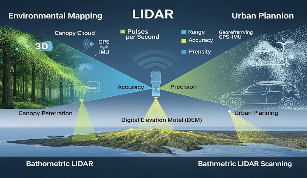
Point Cloud
A point cloud is the collection of data points generated by a LiDAR scan. Each point represents a measurement in three-dimensional space, and together, they form a detailed 3D model of the scanned area.
Pulses per Second (PPS)
This refers to the number of laser pulses a LiDAR system emits every second. Higher PPS values generally mean more detailed and accurate data.
Range
The range is the maximum distance a LiDAR sensor can measure effectively. This can vary depending on the type of system, environmental conditions, and the reflectivity of the target surface.
Accuracy and Precision
Accuracy refers to how close the measurement is to the true value. Precision describes how repeatable or consistent those measurements are. Both are vital for reliable results.
Intensity
Intensity is the strength of the return signal from a laser pulse. It can reveal important surface characteristics, such as whether a material is reflective, rough, or absorbing.
Digital Elevation Model (DEM)
A DEM is a 3D representation of the earth’s surface, generated using LiDAR data. DEMs are widely used in planning, construction, flood modelling, and environmental monitoring.
Canopy Penetration
One of LiDAR’s unique advantages is its ability to “see through” vegetation. Canopy penetration refers to the system’s ability to capture data about the ground surface even beneath thick tree cover.
Scanning Angle
The scanning angle is the width of the area that the LiDAR system covers. Wider angles capture more area in a single pass but may affect accuracy at the edges.
Georeferencing
Georeferencing links LiDAR data to a specific location on Earth’s surface, often using GPS and inertial measurement units (IMUs). This ensures the point cloud data is spatially accurate.
Bathymetric LiDAR
Unlike standard systems, bathymetric LiDAR is designed to penetrate water. It uses green wavelengths of light to map riverbeds, lakes, and coastal areas.
Why Knowing These Terms Matters
For engineers, surveyors, and planners, understanding LiDAR terminology is more than technical jargon—it’s the foundation for interpreting data correctly, making informed decisions, and ensuring accuracy in projects. Even for newcomers, recognising these terms helps demystify the technology and highlights its wide-ranging applications.
LiDAR is transforming how we measure and interact with the world around us. By familiarising yourself with key terms like point cloud, DEM, and georeferencing, you’ll be better equipped to understand its capabilities and applications. As LiDAR continues to advance, so too will the language that surrounds it—making ongoing learning essential for anyone working in fields that rely on spatial accuracy and data precision.


