
What’s next for NSW’s intense storm? Heavy rains, fallen trees – and a chance of a storm ‘slingshot’
- Written by Steve Turton, Adjunct Professor of Environmental Geography, CQUniversity Australia
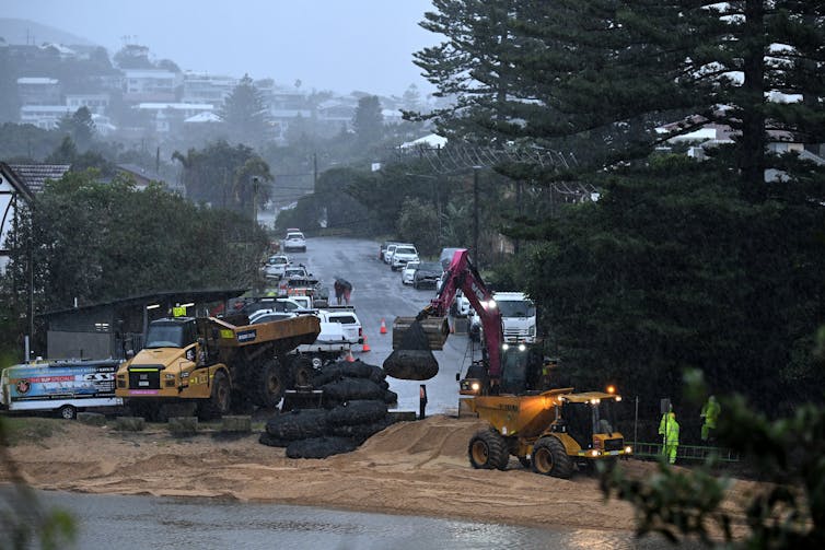
Millions of people in New South Wales hunkered down last night as an intense “bomb cyclone” swept in. Falling trees took out power lines, leaving about 40,000 people without power, while some areas copped 200mm of rain in 24 hours.
Evacuation orders are in place at Wamberal, an erosion hotspot on the NSW Central Coast. Flood warnings are in place for the Nepean and Hawkesbury Rivers in Sydney.
But it could have been significantly worse. That’s because a second, slightly weaker low has formed out to sea, sucking energy away from the main storm. Without it, wave heights would likely have been much higher, and winds and rain would have been more intense. The main storm’s sustained winds offshore were downgraded from storm force (88–116km per hour) to gale force (63–87km per hour).
It’s one reason why the storm didn’t end up being classified as an East Coast Low – an intense and often damaging low-pressure system – but rather as a complex, but vigorous coastal low.
But we can’t relax yet. These two lows may begin to slingshot around each other. One of the storms may well spin off and approach coastlines further south.

A tricky storm to classify
Ahead of its arrival, this storm was shaping up as an East Coast Low – a specific type of very strong storm that emerges when a cold trough high up in the atmosphere triggers a strong low down at sea level.
But while the storm underwent “explosive cyclogenesis” – intensifying rapidly enough to make it a “bomb cyclone” – it didn’t meet the criteria for an East Coast Low.
The emergence of the second low out at sea drew some of the main storm’s energy away and reduced wind speeds and wave heights. This is why it’s considered a complex low. The storm also fell short of the duration of heavy rainfall and severe winds speeds needed to consider it an East Coast Low.
Meteorologists are rightly cautious about classifying a storm as an East Coast Low. That’s because these systems pack a real punch and deserve to be taken seriously on land and at sea.
The infamous 1998 Sydney to Hobart yacht race was hit by a sudden and severe East Coast Low. These storms normally form in cooler months, but this summer storm formed suddenly and made a direct hit on the yacht fleet. Six people died and many more had to be rescued. Intense winds destroyed masts and wild seas made rescue very difficult. That storm was also a bomb cyclone, as it intensified extremely quickly.
In 2007, five East Coast Lows hit. The biggest of these drove the huge Pasha Bulker coal carrier onto Nobbys Beach in Newcastle. In 2016, another East Coast Low led to the memorable image of a swimming pool collapsing onto a beach after huge waves caused erosion.

Spinning storms
One unusual thing about this storm is its core. If you didn’t know better, you might think it was a tropical cyclone.
Storms like this one can also be classified as extratropical cyclones if they’re strong enough. That’s because they have the characteristic whirling cyclonic shape on radar. But there are important differences.
Tropical cyclones have warm cores and their strongest winds near the core, whereas these storms affecting more southerly regions mostly have cold cores and the strongest winds further out. At certain times of year, they may be “hybrid” systems, showing both tropical and extratropical features.
The emergence of the second low is likely to trigger the “dumb-belling effect”, a two-way interaction very similar to the Fujiwhara effect in which two tropical cyclones begin to spin around each other.
A Bureau of Meteorology video explaining the Fujiwhara effect.How does this happen? When two tropical or extratropical cyclones form close to each other, their low-pressure centres begin to orbit around a common point influenced by the intensity and relative size of each cyclone. This interaction can lead to the cyclones merging, intensifying or even altering their paths.
In the southern hemisphere, the two orbiting storms spin clockwise. That means it’s most likely the stronger low sitting off NSW will be spun northeast back out to sea, and the second low will spin southwest, possibly bringing more heavy rain and strong winds to southern NSW and eastern Victoria.
Authors: Steve Turton, Adjunct Professor of Environmental Geography, CQUniversity Australia