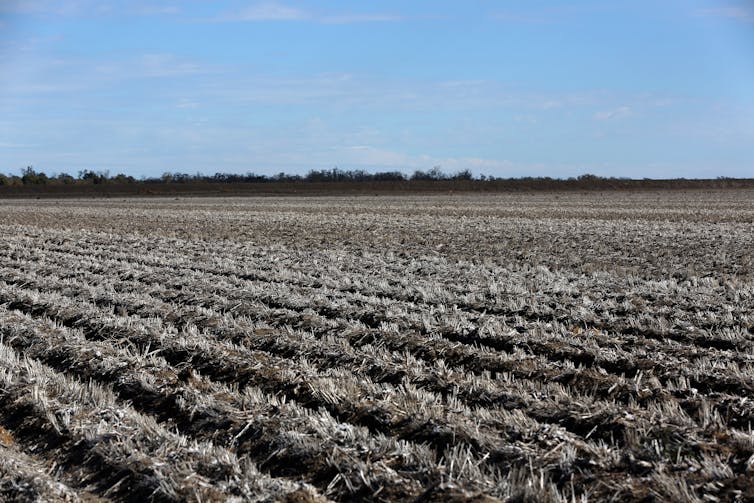
Cotton on: one of Australia's most lucrative farming industries is in the firing line as climate change worsens
- Written by Milton Speer, Visiting Fellow, School of Mathematical and Physical Sciences, University of Technology Sydney

The northern Murray-Darling Basin produces 93% of Australia’s cotton. Cotton is one of Australia’s biggest agricultural industries – worth about A$2 billion each year – and a steady supply of water is crucial for production.
Our recently published research reveals that since the 1990s, average April-May rainfall in the northern basin has decreased significantly. The decrease coincides with accelerated climate change.
Our research also found average or below-average rainfall in the remaining cool season months June to September. Without substantial spring or summer rain, this leads to less rainfall runoff in dams – and less water to irrigate cotton and other crops.
Climate change will bring more frequent droughts, as well as more frequent flooding. These two future extremes in rainfall both have the potential to damage Australia’s lucrative cotton industry.
A vital river system
The northern Murray-Darling Basin spans northeast New South Wales and southeast Queensland. It comprises floodplains of streams or small rivers that feed into the Darling River.
Cotton in the basin is mostly grown on clay soils on floodplains next to rivers. When rivers flood after heavy rain, the soil stores water for later plant growth.
Water stored in the cooler months ensures an adequate supply of water in summer, when cotton crops require the most water. Insufficient rain in the cooler months means dam water will be needed in summer. But highly variable summer rain means this water is not always available.
Maintaining water flow through the northern Murray-Darling Basin is crucial. Many farms and communities rely on river water for human consumption and to irrigate cotton and other crops. And a sustainable water supply is vital for the ecological health of wetlands, waterholes and floodplains.
What we found
Our research examined annual April-May rainfall in the northern Murray-Darling Basin from 1911 to 2019. Other research has concentrated on autumn rainfall for southeast Australia but not specifically on this part of the basin.
We already knew 94% of water gauges in the northern Murray-Darling Basin showed declining trends in water flow since records began in 1970. Our previous research had also found a declining rainfall trend in April-May in the southern Murray-Darling Basin. So we wanted to see if the trend was similar in the north.
For the drought from 2017 to 2019, almost all the northern parts of the basin experienced their driest ever period or close to it.
But the consecutive La Niñas of 2020-21 and 2021-22 brought heavy rain to the northern Murray-Darling Basin – filling dams and leading to flooding.
Rain is generated by short-term events such as thunderstorms, as well as large-scale systems. In eastern Australia, these include climate drivers such as the El Niño-Southern Oscillation, Southern Annular Mode and Indian Ocean Dipole.
These climate drivers influence weather over months and seasons. In the northern Murray-Darling Basin, they’re responsible for highly variable seasonal and annual rainfall. Specifically, we found:
- the El Niño-Southern Oscillation influences spring/summer rainfall
- the Southern Annular Mode affects summer rainfall
- the Indian Ocean Dipole is important for late winter/spring rainfall.
Significantly, global warming was a prominent contributor to extremes of rainfall in all seasons, both individually and in combination with other climate drivers.
North vs south
Typically, it rains more in the northern Murray-Darling Basin during the warmer season, and more in the south in the late cool season. Both receive significantly decreased rainfall in April and May.
So in the north, reduced April-May rainfall, coupled with the usual lower rainfall late in the cool season, can mean dams are not full heading into the warmer season where irrigation water is crucial for cotton crops.
A compounding factor is that the northern dams have about one-third the capacity of the south. What’s more, rising temperatures since the 1990s have increased evaporation lost from vegetation across the basin – and during 2018-2019, the evaporation was higher in the north.
So what does all this mean? The results suggest global warming will both increase temperatures and rainfall extremes in the northern Murray-Darling Basin, bringing more frequent droughts and floods. The associated impact on yields will likely threaten the future of cotton farming – by far the basin’s most important crop.
Read more: Cotton breeders are using genetic insights to make this global crop more sustainable
Looking ahead
About 90% of Australia’s cotton crop is irrigated. This changes each year depending on how much natural rainfall is received across the cotton-growing catchments.
Our research confirms rainfall extremes in the northern Murray-Darling Basin are increasing. The subsequent longer and more frequent droughts and floods are likely to lead to lower cotton yields, which may affect the livelihood of the communities dependent on cotton farming.
River flows are affected by both rainfall and human management of rivers, such as the allocation of water for irrigation and other uses. More accurate rainfall models are needed to help state and local water authorities make crucial management decisions. These models should predict the climate drivers identified in our study.
Authors: Milton Speer, Visiting Fellow, School of Mathematical and Physical Sciences, University of Technology Sydney


