

Mangroves from space: 30 years of satellite images are helping us understand how climate change threatens these valuable forests
- Written by: Nicolás Younes Cárdenas, Postdoctoral research fellow, James Cook University
Australia is home to around 2% of the world’s mangrove forests and is the fifth most mangrove-forested country on Earth. Mangroves play a crucial role in the ecosystem thanks to the dizzying array of plants, animals and birds they feed, house and protect.
Mangrove forests help protect coastal communities from cyclones and storms by absorbing the brunt of a storm’s energy. They help our fight against climate change by storing vast amounts of carbon that would otherwise be released as greenhouse gases.
In other words, mangroves are some of our most precious ecosystems. Despite their importance, there is much we don’t know about these complex wetland forests. For example, when does their growing season start? And, how long does it last?
Usually, answering these types of questions requires frequent data collection in the field, but that can be costly and time-consuming. An alternative is to use satellite images. In the future, this will allow us to track the impacts of climate change on mangroves and other forests.
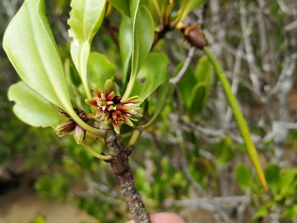 Mangroves play a crucial role in the ecosystem thanks to the dizzying array of plants, animals and birds they feed, house and protect.
Nicolas Younes
Mangroves play a crucial role in the ecosystem thanks to the dizzying array of plants, animals and birds they feed, house and protect.
Nicolas Younes
What is phenology?
Our research used satellite images to study the life cycles of mangrove forests in the Northern Territory, Queensland, and New South Wales. We compared the satellite images with field data collected in the 1980s, 1990s and 2000s, and found a surprising degree of variation in mangrove life cycles.
We’re using the phrase life cycle, but the scientific term is “phenology”. Phenology is the study of periodic events in the life cycles of plants and animals. For example, some plants flower and fruit during the spring and summer, and some lose their leaves in autumn and winter.
Phenology is important because when plants are growing, they absorb carbon from the atmosphere and store it in their leaves, trunks, roots, and in the soil. As phenology is often affected by environmental conditions, studying phenology helps us understand how climate change is affecting Australian ecosystems such as mangrove forests.
So how can we learn a lot in a short amount of time about mangrove phenology? That’s where satellite imagery comes in.
How we use satellites to study mangrove phenology
Satellites are an excellent tool to study changes in forest health, area, and phenology. Some satellites have been taking images of Earth for decades, giving us the chance to look back at the state of mangrove forests from 30 years ago or more.
You can think of satellite images much like the photo gallery in your smartphone: you can see many of your family members in a single image, and you can see how everyone grows and “blooms” over time. In the case of mangroves, we can see different regions and species in a single satellite image, and we can use past images to study the life cycles of mangrove forests.
For example, satellite images depicted below, which use data from the Australian government’s National Maps website, show how mangroves forests have changed in the Kimberley region of Western Australia between 1990 and 2019. You can see how the mangrove forest has reduced in some areas, but expanded in others. Overall, this mangrove forest seems to be doing pretty well thanks in large part to the fact this area has a reasonably small human population.
Images: NationalMap/Data61Our study of satellite images of mangrove forests in the Northern Territory, Queensland, and New South Wales - and how they compared with data collected on the ground - found not all mangroves have the same life cycles.
For instance, many mangrove species grow new leaves only once per year, while other species grow new leaves twice a year. These subtle, but important differences will allow us to track the impacts of climate change on mangroves and other forests.
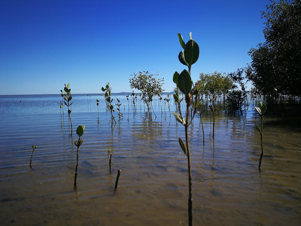 Satellite images of mangrove forests reveal not all mangroves have the same life cycles. Here we see mangroves at different growth stages.
Nicolas Younes
Satellite images of mangrove forests reveal not all mangroves have the same life cycles. Here we see mangroves at different growth stages.
Nicolas Younes
How climate change affects mangrove phenology
Climate change is changing the phenology of many forests, causing them to flower and fruit earlier than expected.
Science cannot yet tell us exactly how mangrove phenology will be affected by climate change but the results could be catastrophic. If mangroves flower or fruit earlier than expected, pollinators such as bats, bees and birds may starve or move to a different forests. Without pollinators, mangroves may not reproduce and can die.
The next step in our research is to figure out how climate change is affecting the life cycles of mangroves. To do this, we will use satellite images of mangroves across Australia and factor in data on temperature and rainfall.
We think rising temperatures are causing longer periods of leaf growth, a theory we plan to test by studying data from now with satellite images from the 80s and 90s.
 The next step in our research is to figure out how climate change is affecting the life cycles of mangroves.
Shutterstock
The next step in our research is to figure out how climate change is affecting the life cycles of mangroves.
Shutterstock
Satellite monitoring can’t do it all
Satellites can tell us a lot about how a mangrove forest is faring. For example, satellite images captured a dieback event (depicted below, using data from the Australian government’s National Maps website) that happened between 2015 and 2016, when around 7,400 hectares of mangroves died in the Gulf of Carpentaria due to drought and unusually high air and sea temperatures.
Images: NationalMap/Data61But satellite monitoring is not enough on its own and cannot capture the detail you can get on the ground. For example, satellites cannot capture the flowering or fruiting of mangroves because flowers are often too small and fruits are often camouflaged. Also, satellites cannot capture what happens under the canopy.
It is also important to recognise the work of researchers on the ground. Ground data allows us to validate or confirm the information we see in satellite images. When we noted some mangrove forests were growing leaves twice per year, we validated this observation with field data, and confirmed with experts in mangrove ecosystems. Field data is crucial to understand the life cycles of ecosystems worldwide and how forests are responding to changes in the climate.
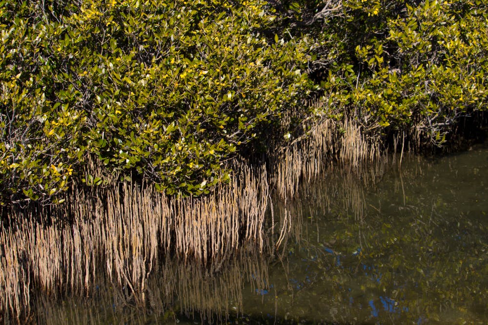
 Wetlands, including mangroves, are some of our most precious ecosystems.
Shutterstock
Wetlands, including mangroves, are some of our most precious ecosystems.
Shutterstock
Authors: Nicolás Younes Cárdenas, Postdoctoral research fellow, James Cook University


